
BY SALT SPRING ISLAND SEARCH & RESCUE
When Salt Spring Island Search and Rescue (SSISAR) first began exploring use of a drone several years ago, the volunteers were working with little more than concepts, creativity and a donated consumer-level quadcopter.
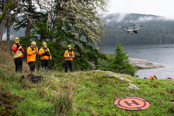
Today, eight months after securing funding for a major upgrade, the team has a powerful new tool in its arsenal: an enterprise-grade drone designed for complex tasks that is capable of flying in harsh weather, seeing in the dark and pinpointing (literally with laser precision) the exact location of someone in distress.
The new aircraft, a DJI Matrice-series drone equipped with thermal imaging, high-resolution zoom cameras and a laser range finder, represents a significant leap forward for search and rescue operations on Salt Spring Island and across the Southern Gulf Islands. Alongside it, the team also secured a new smaller training drone, allowing new pilots to build skills without tying up the primary mission aircraft.
For the drone team, this isn’t about technology for technology’s sake. This is technology that will help them find people faster, while keeping ground teams safer. It will let them search areas more quickly, even when conditions are less than ideal — a frequent reality where we live.
Before the upgrade, the drone team was relying on a small five-year-old drone. While SSISAR was grateful for that initial drone donation that got them started down this path, it was starting to show its age. It was useful in calm, dry conditions, but it could not fly in rain, snow or even heavy humidity. Battery life was limited, there was no thermal camera to detect heat signatures and the small phone-based controller made it difficult to maintain situational awareness during complex searches.
Those limitations are now largely gone. The new drone is weather-resistant and designed for emergency services use. It can fly in rain and wind, operate in cold winter temperatures and stay airborne for extended missions. Its thermal camera allows operators to detect body heat through darkness, foliage or light ground cover.
Using special software developed out of Squamish, the drone also integrates with the existing search management and mapping software used by SAR teams across B.C., which provides a real-time understanding of the drone’s progress and location. When pilots locate a subject or item of interest, the onboard laser range finder can generate precise GPS coordinates of a person or object spotted from the air. Those coordinates, and photos from the drone’s onboard cameras, can be shared instantly with ground teams and search managers, reducing guesswork and saving valuable time.
These tools are no longer experimental; they are becoming a standard part of modern SAR, and we’re proud to bring that capability to Salt Spring Island.